
The First Light of 2026: A Complete Guide to Catching India’s Earliest Sunrise in Dong Valley
Standing at the absolute longitudinal boundary of the Eastern Himalayas, Dong Valley is the precise geographic milestone where India witnesses its earliest sunrise every day. Our comprehensive 2026 expedition guide maps out the overland corridor tracking the turquoise waters of the Lohit River from Dibrugarh to Walong. Discover how to navigate the midnight trek architecture safely across the Tilam suspension bridge, secure mandatory online Inner Line Permits effortlessly, and equip your gear framework for extreme high-alpine temperature swings. Step away from the crowds and greet the first light of the nation with BREEZIAH.
Quick Summary: India's Ultimate Chronological Frontier
- The Core Phenomenon: Dong Valley, tucked into the far eastern corner of Arunachal Pradesh's Anjaw district, is the precise geographic location where India witnesses its earliest sunrise every day.
- The 2026 Trending Focus: "Chronological Frontier Overlanding"—a growing shift toward remote, high-altitude boundary tracking where travelers explicitly seek extreme geographic milestones, astronomical alignment, and low-density wilderness over conventional sight-seeing loops.
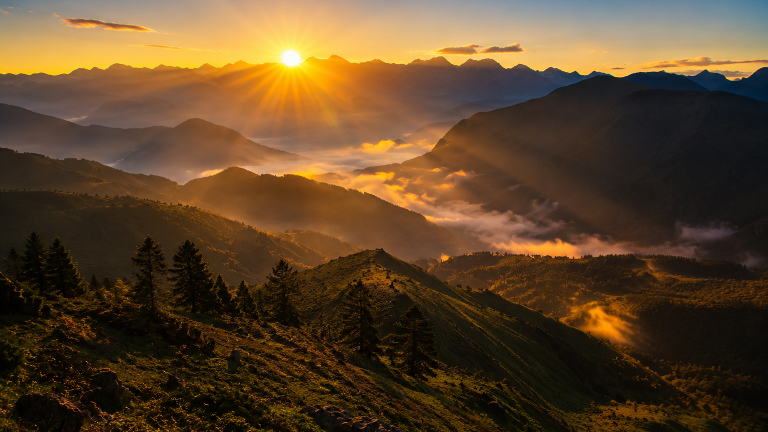
- The Visual Payoff: Due to India's unified single time zone ( +5: 30 GMT)the sun breaks over the morning crests of Dong between 4:15 AM and 5:15 AM depending on the seasonal window, casting a bright crimson glare over the misty mountains while the rest of the nation remains in deep pitch-darkness.
- The Operational Reality: Reaching this isolated alpine node requires a dedicated multi-day overland journey across the Lohit River valley, followed by an active, high-sensory pre-dawn mountain trek.
- The Strategic Verdict: Dong is an uncompromising, raw expedition meant for purists who want to stand at the absolute structural edge of the nation's map.
1. The Chronological Matrix: Dong Valley’s Unique Geography
To understand why the sun breaks first over Dong Valley, one must view the Eastern Himalayas through the lens of absolute longitudinal placement. Dong sits at a sharp coordinate intersection near the tri-junction of India, China, and Myanmar. Located at an approximate longitude of 97° 24E, it stands as the literal easternmost inhabited valley ecosystem in the country.
[Mumbai Sunrise: ~7:15 AM] <==================== [Unified IST Time Zone] <==================== [Dong Sunrise: ~4:30 AM]
Because India manages its entire geographic expanse under a single, unified Indian Standard Time (IST) meridian, this extreme longitudinal positioning creates a massive solar variance. When the first rays of morning light pierce the high pine ridges of the blue hills in Dong, cities like Mumbai or New Delhi are still wrapped in deep night, with daylight lagging up to two full hours behind. Standing on the dew-soaked grassy meadows of Dong at 4:30 AM isn't just about watching a beautiful morning sky; it is a literal shift in your perception of time and geography.
2. The Legal Framework: Inner Line Permits for the Anjaw Frontier
Because the Anjaw district shares sensitive international boundary lines along the high mountain passes of the Eastern Himalayas, access to this region is tightly protected by national security mandates.
- The Inner Line Permit (ILP) Mandate: Every domestic Indian traveler crossing into the state requires an active, validated Inner Line Permit. This document must be verified at state border checkposts before your vehicle is cleared to enter the mountain highway lines.
- The Digital Processing Portal: At BREEZIAH, our operations desk structures and processes these security clearances directly through the state’s automated digital portals, ensuring your documentation package is completely cleared well ahead of your departure date.
- Internal Link: To review the step-by-step document requirements, file upload sizes, and verification rules for this boundary control document, read our definitive Arunachal Pradesh ILP Guide Online.
3. The Expedition Route: Mapping the Overland Corridor from Dibrugarh
Unlike the well-trodden tourist trails of the western districts, getting to the far eastern edge of the state requires a distinct logistical layout. You cannot efficiently access Dong via the standard Assam plains corridors near Tezpur or Guwahati. Instead, your base node for transit must anchor at the industrial river town of Dibrugarh.
[Dibrugarh Airport] ===> [Dr. Bhupen Hazarika Bridge] ===> [Wakro/Parsuram Kund] ===> [Hayuliang Ridge] ===> [Walong Base]
The overland journey tracking northeast from Dibrugarh is a visual showcase of shifting ecosystems. Your vehicle will cross the sweeping waters of the Lohit River via the historic Dr. Bhupen Hazarika Bridge, leave the flat tea estates of upper Assam behind, and make a vertical climb into the steep, pine-covered canyons of the Mishmi and Anjaw Hills.
4. Day-by-Day Expedition Blueprint: The Road to First Light
To execute this journey smoothly without driver fatigue or logistical delays, we organize the itinerary into precise operational segments:
Day 1: Dibrugarh Arrival to Tezu/Wakro Foothills
Your journey begins with a morning pickup from Dibrugarh airport. Boarding a private, high-clearance SUV, you immediately move northeast across the broad floodplain channels of the Brahmaputra basin. Cross the state boundary lines, pass through the security checkpoints, and enter the lower foothills of Lohit district. Spend the evening resting at a comfortable eco-lodge or local homestay in Wakro or Tezu, absorbing the sights of local ginger plantations.
- Internal Link: For an unvarnished review of the critical safety parameters and common operational errors to avoid across these remote state transit checkpoints, study our Arunachal Pradesh Is It Safe to Travel Guide.
Day 2: Tezu to Hayuliang Ridge ( 2,780 ft )
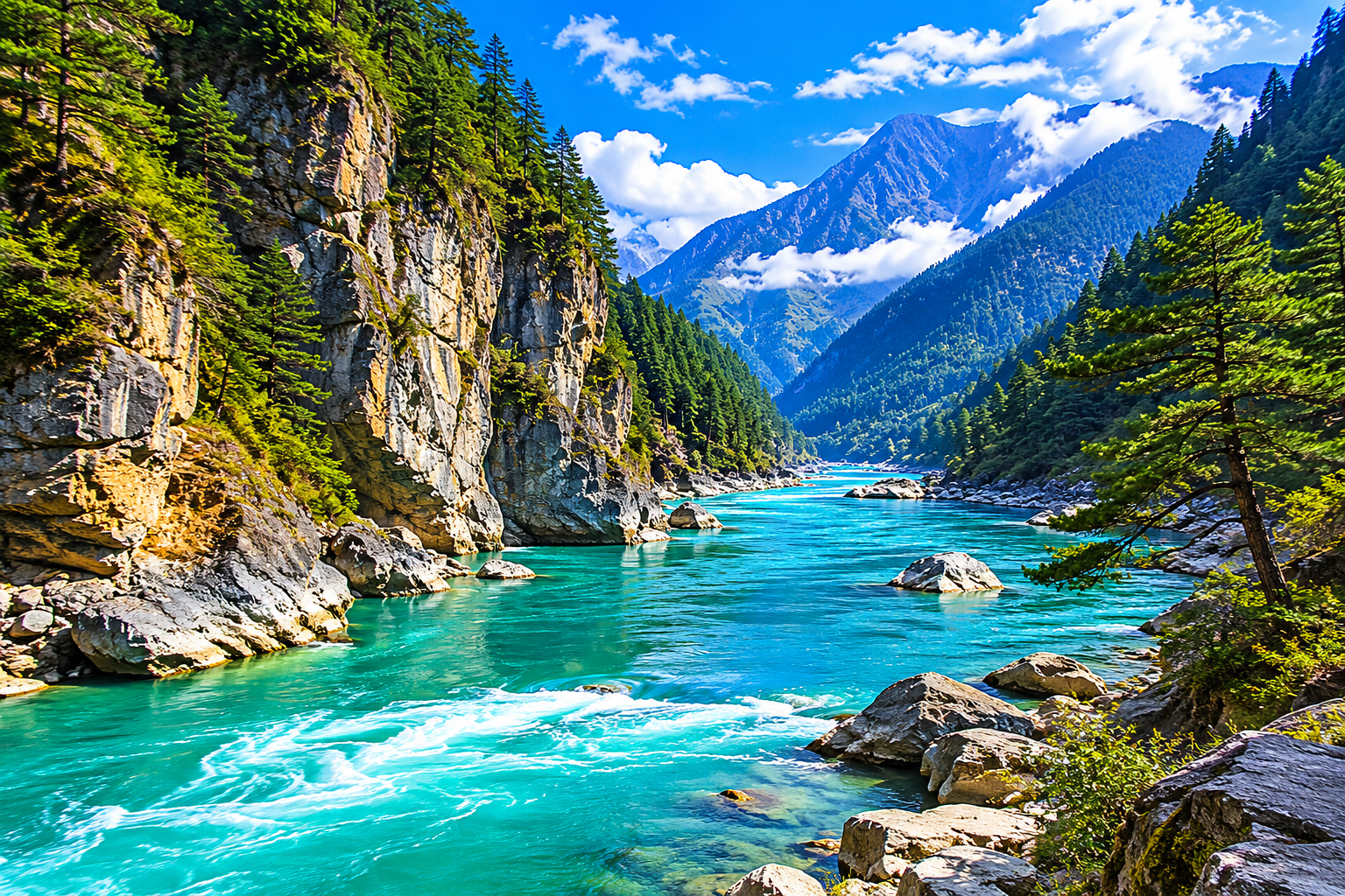
Break camp at 8:00 AM to begin your formal ascent into the deep mountain valleys, tracking parallel to the roaring turquoise waters of the Lohit River. The road winds through steep, vertical river gorges covered in dense subtropical rain forests. You will cross Parsuram Kund, a sacred Hindu pilgrimage pool set within a dramatic rock basin where the Lohit River breaks cleanly out into the lowlands. End your day along the breezy, high mountain ridge town of Hayuliang, where the cooler air signals your entry into the high-altitude zone.
Day 3: Hayuliang to Walong Base Camp (3,580 ft )
Today your vehicle moves deeper into the inner frontier lines, heading toward the historic military outpost of Walong. As the altitude climbs, the broad-leaved tropical forests thin out, replaced by steep, vertical cliffs lined with majestic blue pine trees (Pinus wallichiana).
Arrive in Walong by early afternoon. This region is famous for its raw, unfiltered history; it was the site of the intense Battle of Walong during the 1962 Sino-Indian conflict. Spend your afternoon walking through the quiet military memorials, visiting the natural hot springs along the riverbanks, and checking into your rustic, community-vetted homestay to prepare for the midnight sunrise trek.
- Internal Link: Curious about how these remote Eastern Himalayan valleys contrast with the classic, orchard-filled valleys of the western circuits? Check out our master guide to The Best Things to Do in Dirang.
5. The Sunrise Trek Architecture: Pacing Your Pre-Dawn Ascent
Catching India's earliest sunrise requires an intense, focused effort. This is not a casual morning stroll; it is a dedicated pre-dawn mountain trek that demands proper discipline and physical endurance.
[Midnight Wakeup] ---> [1:30 AM Tilam Suspension Bridge Check] ---> [3-Hour Steep Alpine Climb] ---> [4:30 AM Sunrise Plateau]
The Midnight Wakeup Protocol
Your alarm will sound at midnight. After a quick cup of hot black tea inside your homestay base, your group will board your 4x4 transport at 1:00 AM to drive a short distance to the tiny village of Tilam, situated on the left bank of the Lohit River.
The Suspension Bridge Crossing
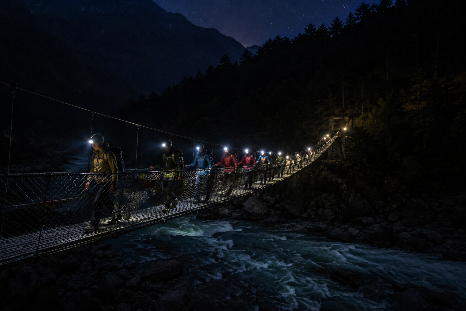
At 1:30 AM, equipped with high-intensity headlamps, you will cross the foot of a long, swaying iron suspension bridge over the roaring waters of the Lohit River. This river crossing marks the formal start of the sunrise track.
The Alpine Climb Architecture
The trail scales the steep, vertical walls of the ridge line over a distance of roughly 3.5 miles .The path climbs steadily through dense pine woods, over exposed root systems, and across a series of steep switchbacks.
- Hours 1 & 2: The trail climbs steeply through the dark forest canopy. Maintain a steady, rhythmic breathing pattern as you navigate the dirt track.
- Hour 3: The forest opens up into wide, high-alpine grass meadows as you approach the mountain crest at an elevation of roughly 4,100 feet.
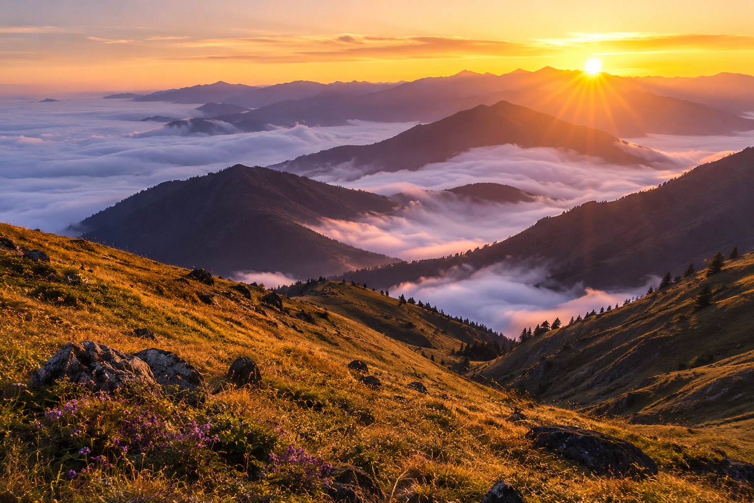
- The Climax (4:30 AM): Stand firmly on the open grassy plateau of Dong. Look eastward toward the jagged mountain ridges of Myanmar. The dark sky will shift rapidly from a deep indigo to a bright, explosive crimson orange, illuminating the jagged mountain walls and highlighting the layer of white river mist trapped in the valley far below.
6. Seasonality: Tracking the Optimal Clear-Sky Windows
Because the sunrise experience depends entirely on high-altitude sky visibility, picking your travel dates is critical to your trip's success.
The Winter Peak (November to February)
This is the optimal clear-sky window for the Anjaw district. As the monsoon completely clears the atmosphere, the mountain air settles into a state of crisp clarity. The probability of catching an unobstructed sunrise at the edge of the horizon sits at its highest. However, keep in mind that winter temperatures on the high plateau drop sharply below freezing, demanding proper cold-weather gear.
The Spring Shoulder (March to April)
A beautiful time for travelers who want to see the valleys come alive with color. The mountain trails are decorated with wild rhododendrons and alpine orchids. The morning air is warmer, making the 1:30 AM climb physically easier, though you may meet occasional high-altitude clouds.
The Monsoon Shutdown (May to September)
We do not recommend or operate expeditions to Dong Valley during the core monsoon months. The Anjaw district faces intense, unrelenting rainfall. The winding mountain highways alongside the Lohit River are prone to severe mudslides and rockfalls, closing the routes for days at a time and completely blocking out the morning sun.
- Internal Link: If your holiday window is capped strictly within these summer or wetter months, look south toward the stable limestone plateaus of Meghalaya by checking out our Ultimate 7-Day Meghalaya Itinerary.
7. The Tactical Gear Blueprint: Preparing for Extreme Temperature Swings
The physical challenge of the Dong sunrise trek lies in managing intense, rapid temperature swings. When you launch your steep climb from the riverbed at 1:30 AM, your body will generate significant heat, causing you to sweat. However, once you reach the wind-swept, open grassy meadows of the sunrise plateau at 4:30 AM, you will stand completely exposed to piercing alpine winds in sub-zero cold while waiting for the sun to rise.
To stay warm, dry, and comfortable, you must abandon single heavy jackets in favor of a specialized Three-Layer Technical System:
- The Moisture Base Layer: Wear premium Merino wool or a technical synthetic thermal top. Avoid standard cotton shirts completely; cotton absorbs sweat and holds it cold against your skin, increasing your risk of hypothermia in high mountain winds.
- The Insulating Core: Pack a technical high-loft fleece jacket or a compressible down parka within your daypack, ready to layer on the moment you reach the open summit plateau.
- High-Intensity Headlamps: Do not attempt to navigate the steep pine woods using a basic smartphone flashlight. You need a dedicated, hands-free tactical headlamp with a minimum brightness of 200 lumens to keep your hands free for balancing on steep dirt tracks.
- Internal Link: Cross-reference your gear framework with our complete, itemized high-altitude checklist: What to Pack for an Arunachal Pradesh Trip.
8. Cultural Guardrails: The Meyor Tribe and Frontier Lineages
Travel through the far eastern corners of the Anjaw district brings you into contact with one of India's smallest and most isolated indigenous communities: The Meyor Tribe.
The Meyor people are a distinct ethnic group with a tiny population footprint, residing in a small cluster of villages across the Walong and Kibithu circles. Practicing Mahayana Buddhism mixed with traditional animist beliefs, the Meyors maintain an intimate connection with the blue pine forests and rivers that shape their home. Their traditional wooden architecture, distinct linguistic patterns, and sustainable farming systems offer a rare glimpse into an ancient way of life that has remained unchanged for centuries.
When you journey under the BREEZIAH banner, your exploration directly supports these small border communities. We utilize hand-vetted Meyor homestays, partner with local youth trail guides, and ensure your entry fees directly support the preservation of local traditions, creating a meaningful foundation for sustainable travel along the frontier.
9. Logistical Safety Parameters: Road Conditions and 4x4 Demands
The road trip through the Anjaw Hills is an incredible adventure, but it demands serious respect for the mountain terrain.
[Dibrugarh Flat Asphalt] ===> [Winding River Gorges] ===> [Remote Unpaved Ridge Tracks]
The mountain highway alongside the Lohit River features steep vertical cliffs, single-lane rock cuts, and unpaved gravel sectors that can change rapidly with local weather patterns. Attempting to navigate this remote frontier in a standard low-clearance compact car or a front-wheel-drive sedan can quickly lead to mechanical breakdowns or safety issues.
At BREEZIAH, we ensure your journey is smooth and secure by utilizing premium, high-clearance SUVs (such as heavy-duty 4x4 Scorpio or Innova Crysta platforms) driven by seasoned local pilots who understand the unique traction profiles of mountain roads, ensuring your absolute safety from the moment you leave the plains.
- Internal Link: Ready to book a turn-key overland journey across the high passes of the state? Explore our signature managed package: Majestic Tawang Himalayan Escape: 7 Days of Monasteries, Lakes, and Passes.
- Internal Link: Expand your itinerary goals across the wider region by checking our authoritative list of Places to Visit in Arunachal Pradesh.
10. Frequently Asked Questions (FAQ)
Helpful Answers
Frequently Asked Questions
Q: What is the exact time of sunrise in Dong Valley?
A: Because Dong is situated in the extreme eastern corner of the nation, the sun breaks over the horizon between 4:15 AM (during peak summer) and 5:15 AM (during late winter). We schedule your Tilam bridge river crossing strictly between 1:15 AM and 1:30 AM to ensure you reach the summit meadow well before the first crack of morning light.
Q: Is Dong Valley close to Tawang?
A: No. They are located on opposite sides of the state map. Tawang occupies the far western corner bordering Bhutan, while Dong sits at the extreme eastern edge near the Myanmar tri-junction. Traveling between them by road requires a multi-day overland journey across the entire length of the Assam plains.
- If your travel goals point toward the western monastery circuits instead, explore our comprehensive How to Plan the Perfect 7-Day Tawang Road Trip from Guwahati itinerary.
Q: Are there luxury hotels or resorts available in Walong or Dong?
A: No. The Anjaw frontier remains a beautifully wild, untamed region. Accommodations are limited to simple, rustic government guest houses and authentic tribal homestays. These properties offer clean beds, hot water bucket buckets, and wholesome home-cooked local meals, providing a wonderfully genuine base camp for your trek.
Q: Do I need to be an expert trekker to complete the sunrise climb?
A: While you don't need professional mountaineering skills, the trail is steep and climbs consistently over a three-hour window in complete darkness. A good baseline of physical fitness, healthy knee joints, and proper high-traction footwear are essential to enjoy the night hike comfortably.
Ready to stand at the edge of the map and greet the nation's first morning light?
At BREEZIAH, we don’t assemble generic holiday packages; we engineer structurally sound, high-authority overland expeditions designed to foster deep cultural connection and complete safety. Let our operations desk manage your state boundary permits, secure premium 4x4 vehicles, and coordinate hand-vetted local homestays, leaving you free to absorb the magic of the wild.
Plan My Custom Trip | Explore All Tour Packages | Read Our Guest Reviews
Plan This Journey
Turn this Arunachal Pradesh guide into a trip that fits your pace
If this guide is part of the kind of holiday you want, Breeziah can help shape the route, travel flow and stay style around your dates, comfort level and destination priorities.