- Where
- Near Smit, East Khasi Hills
- Altitude
- About 1,700–1,800 m at the top
- Distance
- About 22–25 km from Shillong, 45 minutes–1 hour
- Timings
- Daylight; best at sunrise or sunset
- Entry fee
- Free or a small local fee (reports vary)
- Permit
- None
- Best time
- October–April
- Time needed
- 1–2 hours; a full day to walk down to Rasong
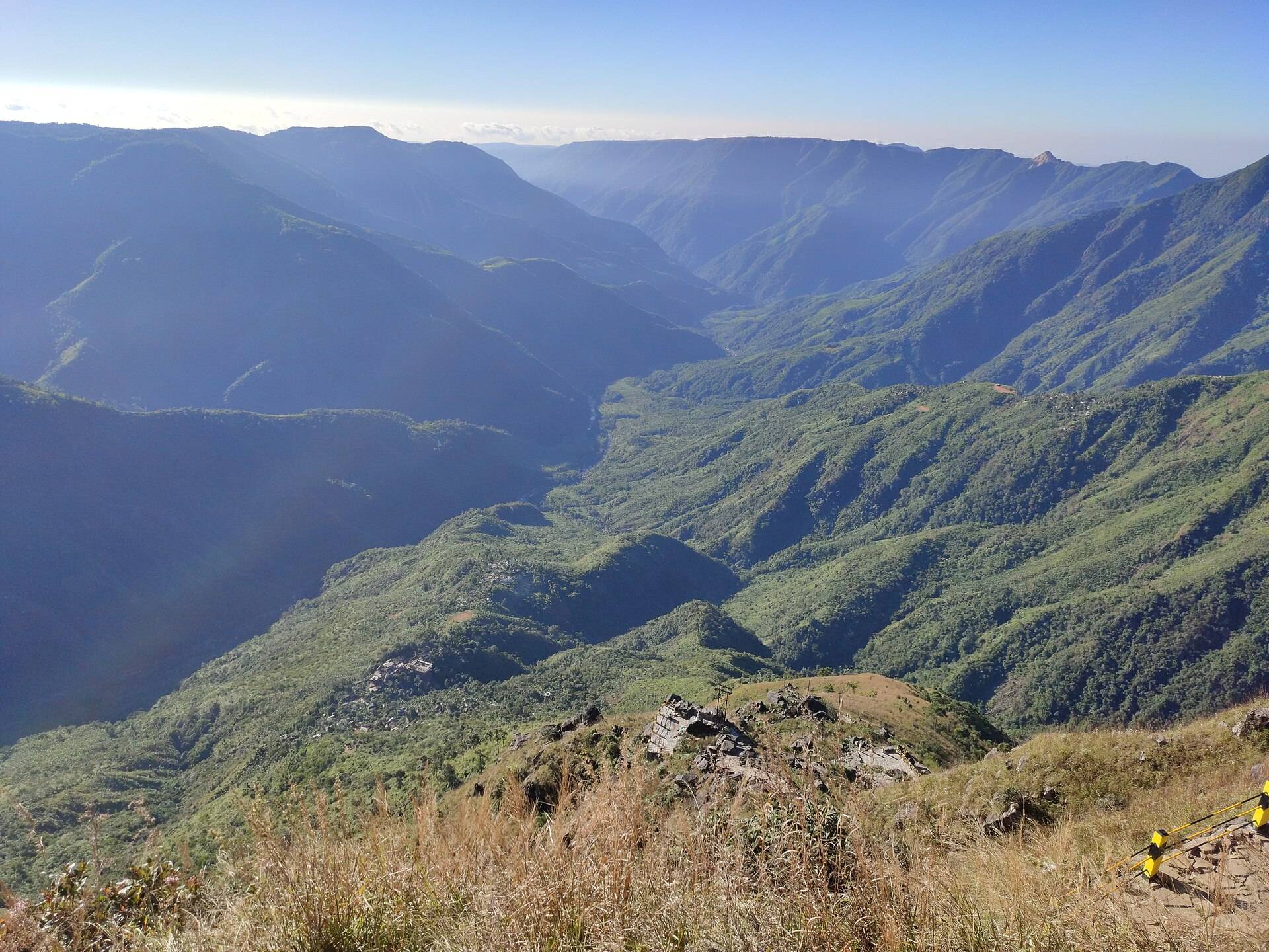
Laitlum means "the end of the hills" in Khasi; some read it as "the end of the road". Both fit. The road from Shillong runs out on a grassy clifftop, and below it the plateau falls away into deep green gorges that stretch towards Bangladesh.
What to do
- Watch sunrise or sunset from the clifftop. On many mornings, mist fills the gorges below you.
- Walk the ridges along the edge for different angles over the canyon.
- Walk down to Rasong, a village at the bottom reached only on foot, by a long stone stairway of around 3,000 steps. Allow 3 to 4 hours there and back, and more for the climb out.
- Photograph the light. The gorges change colour by the minute in the hour before sunset.
How to reach Laitlum
Laitlum is about 22 to 25 km from Shillong via Smit, the last big village, 15 minutes before the canyon. There is no public bus to the top, so book a car. See car rental in Shillong and our top places to visit in Shillong.
| From | Road distance | Usual drive time |
|---|---|---|
| Shillong | about 20 km | 45 min–1 hr |
| Sohra (Cherrapunji) | about 40 km | 1.5 hrs |
| Guwahati Airport | about 140 km | 3.5–4 hrs |
Road distances from OpenStreetMap routing. Drive times are what we see on these mountain roads, not map estimates.
Sunset time by month
Calculated for the 15th of each month. Arrive 45 minutes earlier for the best light.
| Month | Sunset |
|---|---|
| Jan | 4:53 pm |
| Feb | 5:16 pm |
| Mar | 5:31 pm |
| Apr | 5:45 pm |
| May | 6:00 pm |
| Jun | 6:14 pm |
| Jul | 6:16 pm |
| Aug | 5:58 pm |
| Sep | 5:27 pm |
| Oct | 4:56 pm |
| Nov | 4:34 pm |
| Dec | 4:34 pm |
Weather and best time
At about 1,800 m, Laitlum is cool and often windy. The ten-year record shows dry, clear months from November to March and heavy rain from May to September, when cloud often hides the gorges.
| Month | Avg high | Avg low | Rain |
|---|---|---|---|
| Jan | 14°C | 4°C | Dry |
| Feb | 16°C | 6°C | Dry |
| Mar | 19°C | 9°C | Light |
| Apr | 20°C | 12°C | Wet |
| May | 21°C | 14°C | Wet |
| Jun | 22°C | 17°C | Very wet |
| Jul | 22°C | 17°C | Very wet |
| Aug | 22°C | 17°C | Very wet |
| Sep | 22°C | 16°C | Wet |
| Oct | 20°C | 13°C | Wet |
| Nov | 18°C | 9°C | Dry |
| Dec | 15°C | 6°C | Dry |
Monthly averages for 2015–2024 from ERA5 reanalysis via Open-Meteo, at the site's elevation (about 1715 m). Rain and snow are rated relative to this location's own year.
Safety
- The edges are unfenced. Stay well back from the drop, especially in mist or wind.
- Don't go down to Rasong late. The climb back takes longer than you think.
- Hire a local guide for the Rasong walk if you don't know the trail; Meghalaya Tourism recommends it.
Things most guides don't tell you
- Smit is worth a stop. It is the seat of the Khyrim Syiem (chief), and hosts the Nongkrem dance festival, usually in October or November.
- Bring water and snacks. There are only a few small stalls at the top.
- Weekday mornings are empty. Weekend afternoons draw crowds from Shillong.
A sunrise or sunset plan
- Sunrise: leave Shillong about 75 minutes before sunrise (see the table above). Mist often lies in the gorges for the first hour of light.
- Sunset: arrive an hour before sunset, walk the ridges, and leave as the light goes; the road back is narrow and unlit.
- Rasong walk: start by 9am, take a guide, and allow the whole day.
Combine it with
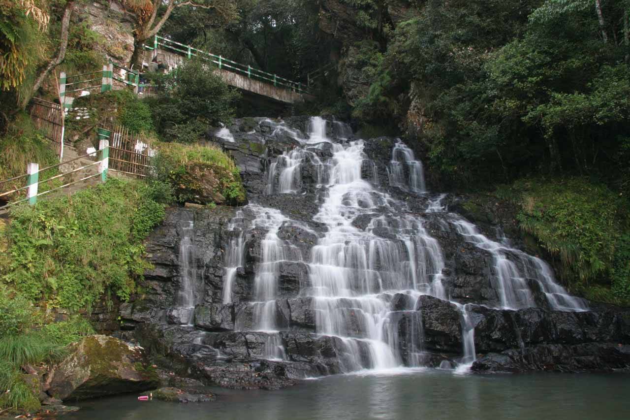
- Elephant Falls on the same side of town.
- Smit village, and the Nongkrem dance ground, on the way.
- Mawkdok Dympep valley viewpoint on the Sohra road if you're heading to Nohkalikai.
Who it suits
The clifftop is open grassland, easy for all ages. The walk to Rasong is a real trek with thousands of steps and only for the fit.
Nearby
- Elephant Falls.
- Nohkalikai Falls and the root bridges at Sohra.
Laitlum Canyons: questions travellers ask
How far is Laitlum from Shillong?
About 22 to 25 km, 45 minutes to an hour by road.
What does Laitlum mean?
The end of the hills in Khasi; some translate it as the end of the road.
Is there an entry fee at Laitlum Canyons?
Reports vary between free entry and a small local fee.
What is the best time to visit Laitlum?
October to April, at sunrise or sunset.
Can I walk down to the bottom of Laitlum?
Yes, a stone stairway of around 3,000 steps leads to Rasong village. Allow 3 to 4 hours there and back.
Is Laitlum safe to visit?
Yes, if you stay back from the unfenced edges, especially in mist or wind.
Is Laitlum in Cherrapunji?
No. It is near Smit, east of Shillong, about 40 km from Sohra.
Is Laitlum open on Sunday?
The viewpoint is open land, but some community-run sites in the Khasi Hills keep shorter hours on Sundays. Check locally.
Sources
- Meghalaya Tourism: Laitlum Canyons
- Meghalaya Tourism: Laitlum
- Ministry of Tourism (rural tourism): Laitlum Canyon
- The Better India: Laitlum Canyons
Timings and fees change. Check on the day, or ask us when you book.