- Where
- Yumesamdong, above Yumthang Valley, Mangan district
- Altitude
- About 4,600–4,700 m (15,300 ft)
- Distance
- About 50 km from Lachung, 23 km beyond Yumthang
- Timings
- Early morning start from Lachung; back by early afternoon
- Entry fee
- No entry fee; vehicle extra of about ₹2,500–3,500 over Yumthang (reported)
- Permit
- North Sikkim permit via a registered operator; Indian nationals only
- Best time
- March–June for snow and open roads
- Time needed
- Half a day from Lachung
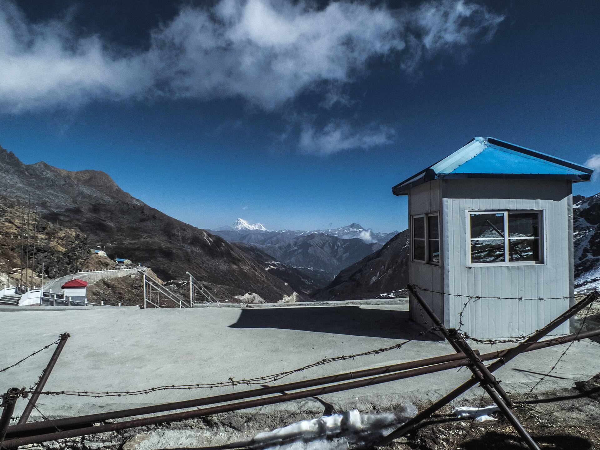
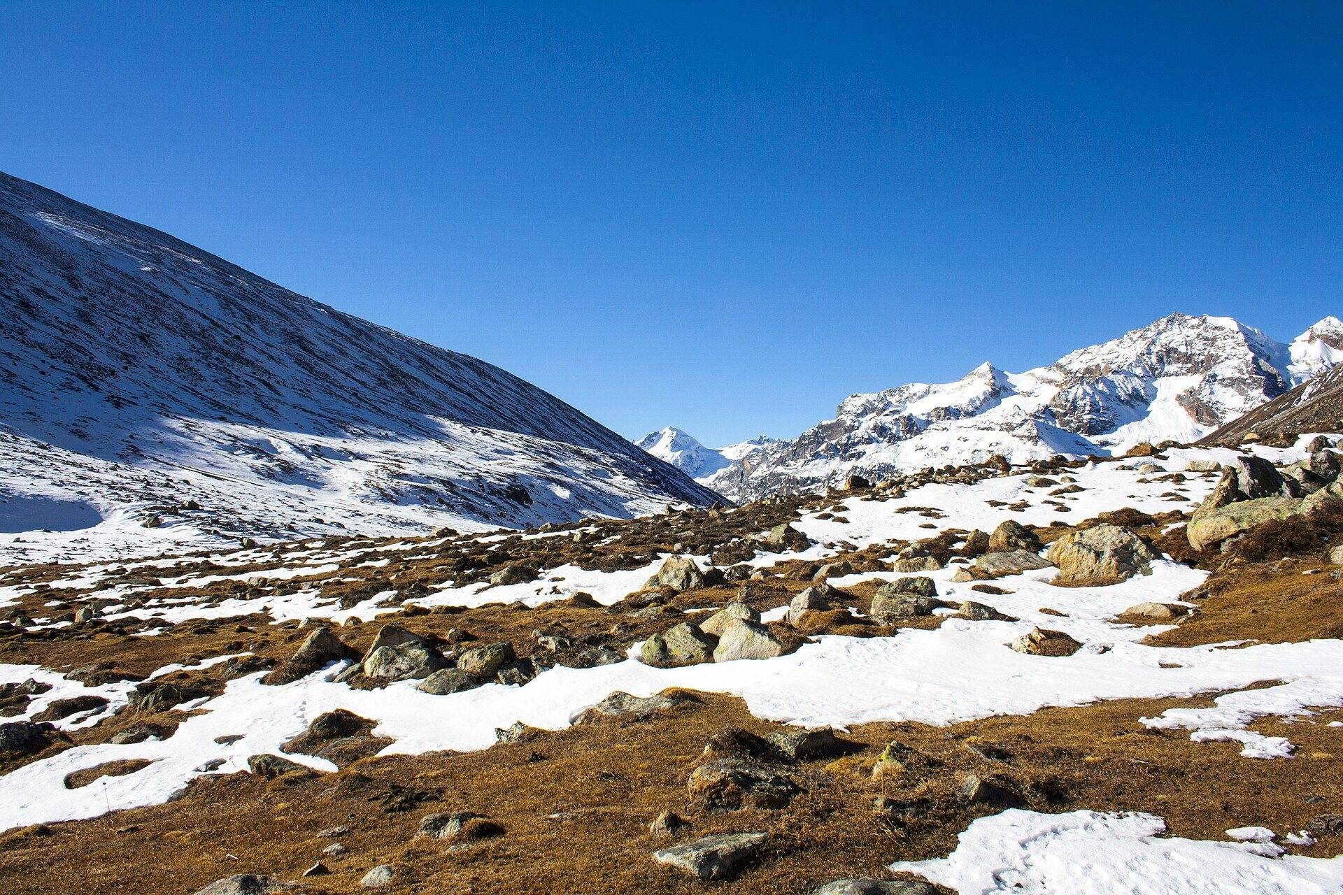
Zero Point, officially Yumesamdong, is the end of the road for civilians in North Sikkim, at roughly 15,300 ft and about 23 km beyond Yumthang Valley. Past the barrier the road is the army's. Most people come for one reason: there is usually snow here when there is none lower down.
What Zero Point is like
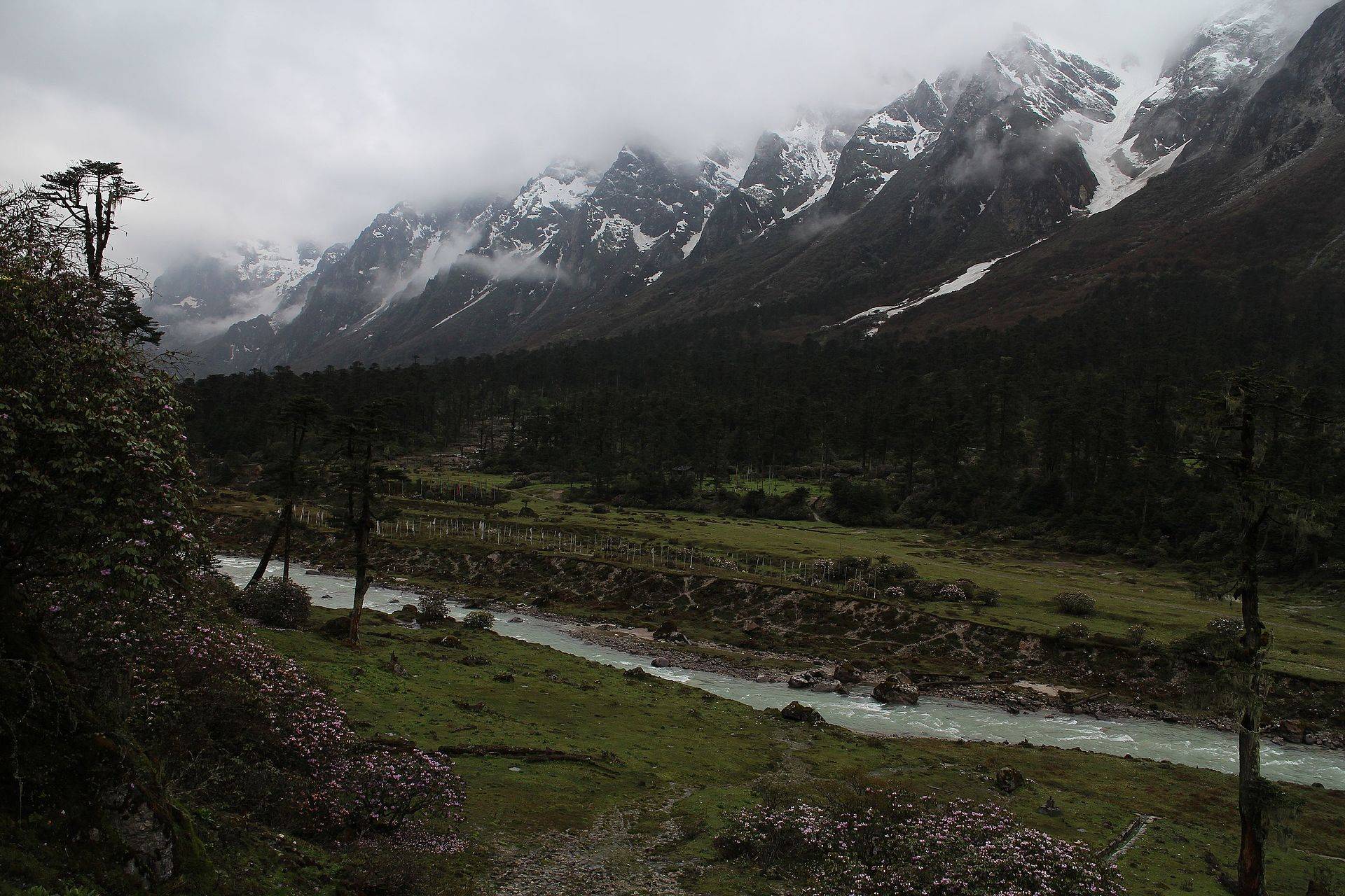
Above the tree line the valley opens into bare slopes, scree and snow, with the Lachung Chu running in from the glaciers. There are no buildings to speak of beyond a few stalls selling tea, noodles and hired gumboots. Expect wind, thin air and, on a clear morning, a ring of snow peaks.
The sulphur hot spring at Yumthang is on the way down, and many drivers stop there on the return.
How to reach Zero Point
Every trip starts from Lachung. You leave around 5–6am, drive to Yumthang, then on to Zero Point and back for lunch. Gangtok to Lachung is a full day, so this is always part of a two- or three-day North Sikkim trip. See our North Sikkim tour packages and Gangtok to Lachung cab.
| From | Road distance | Usual drive time |
|---|---|---|
| Lachung | about 50 km | 2–2.5 hrs |
| Gangtok | about 165 km | Two days, overnight in Lachung |
Road distances from OpenStreetMap routing. Drive times are what we see on these mountain roads, not map estimates.
Permit and cost
- Indian nationals only. Foreigners can reach Yumthang on a permit but not Zero Point.
- The permit is arranged by your Gangtok operator as part of the North Sikkim trip.
- The extra cost: drivers charge on top of the Yumthang trip, reported at about ₹2,500–3,500 per vehicle (2025 figures). Agree it before you leave Lachung.
- Closures: landslides on the Chungthang–Lachung road have shut North Sikkim permits several times, most recently in 2025. Check our guide on whether North Sikkim is open now.
Weather and when there is snow
The ten-year record at this altitude shows snowfall in almost every month, heaviest from March to May. The road is often blocked past Yumthang in mid-winter, so March to May gives the best mix of snow and access.
| Month | Avg high | Avg low | Rain | Snow |
|---|---|---|---|---|
| Jan | -9°C | -15°C | Light | Heavy |
| Feb | -8°C | -14°C | Wet | Heavy |
| Mar | -5°C | -11°C | Wet | Heavy |
| Apr | -2°C | -8°C | Wet | Heavy |
| May | 1°C | -4°C | Wet | Heavy |
| Jun | 5°C | 1°C | Very wet | Heavy |
| Jul | 7°C | 2°C | Very wet | Some |
| Aug | 7°C | 2°C | Very wet | Some |
| Sep | 6°C | 1°C | Very wet | Heavy |
| Oct | 1°C | -4°C | Wet | Heavy |
| Nov | -3°C | -9°C | Light | Some |
| Dec | -5°C | -12°C | Light | Some |
Monthly averages for 2015–2024 from ERA5 reanalysis via Open-Meteo, at the site's elevation (about 4818 m). Rain and snow are rated relative to this location's own year.
- March–May: deep snow at Zero Point, rhododendrons below at Yumthang.
- June–September: monsoon, landslide risk on the way up.
- October–November: clear skies, colder, snow less certain.
- December–February: heavy snow; the road beyond Yumthang often stays shut.
Things most guides don't tell you
- Don't stay long. At 4,600 m people with no altitude history get headaches within half an hour. Keep the visit short and don't drink alcohol the night before. Read our altitude safety guide.
- Hire boots and gloves in Lachung, not at the top, where they are dearer and often wet.
- Children under five and anyone with heart or lung conditions should stop at Yumthang.
- "Zero Point" signs at Katao are a different, separate permit area on the other side of Lachung. Make sure your driver knows which you've paid for.
Nearby
- Yumthang Valley, the flower valley on the way up.
- Gurudongmar Lake, on the Lachen side, usually done the day before.
Zero Point (Yumesamdong): questions travellers ask
What is the height of Zero Point in Sikkim?
About 15,300 ft (around 4,600–4,700 m). Our elevation data for the site gives roughly 4,800 m at the valley floor nearby.
How far is Zero Point from Yumthang?
About 23 km, roughly an hour more each way on a rough road.
Is Zero Point open now?
It depends on snow and landslides. The road is often blocked beyond Yumthang in mid-winter, and permits for all of North Sikkim are suspended after big landslides. Your operator will know the day before.
How much extra does Zero Point cost?
Drivers have charged about ₹2,500–3,500 per vehicle on top of the Yumthang trip in recent seasons. Confirm the figure in Lachung.
Can foreigners go to Zero Point?
No. Foreign nationals may visit Yumthang with a permit but not Zero Point.
Is there snow at Zero Point in May?
Usually, yes. The ten-year weather record shows May as one of the snowiest months at this altitude.
Is Zero Point safe for kids?
Older children are usually fine on a short visit. Very young children and anyone with heart or breathing problems should stop at Yumthang.
Why is it called Zero Point?
It is the point where the civilian road ends. Beyond it the road is for the army only.
Sources
- Ministry of Tourism: Yumesamdong / Zero Point
- Muddie Trails: Zero Point altitude, permit and how to reach
- Discover with Dheeraj: Yumthang Valley travel guide (2026)
- News on AIR: tourists stranded after landslides hit North Sikkim
Timings and fees change. Check on the day, or ask us when you book.