
Mago, Chuna and Gongkar La: 3-Day Itinerary from Tawang (2026)
A three-day plan from Tawang to Mago's hot springs, the Chuna valley and, if the army allows it, Gongkar La lake: route, permits, vehicle, altitude, stays, costs and the best months.
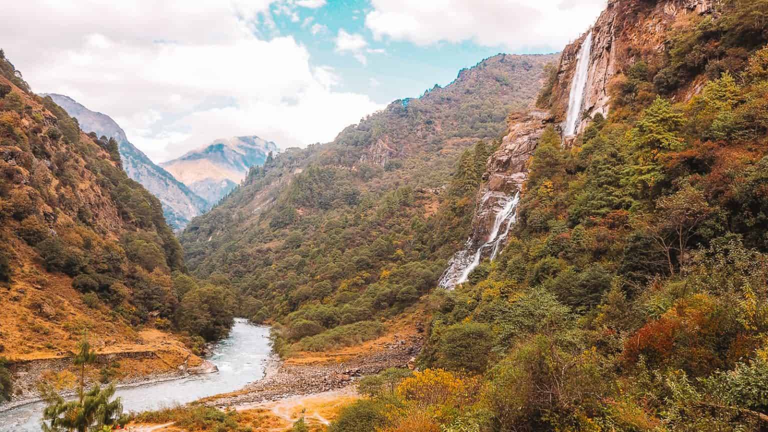
East of Jang, a border road climbs through fir forest to Mago, a village of yak herders at about 11,500 ft with hot springs by the river. Beyond it lie the high Chuna valley and Gongkar La, a pass and glacial lake at roughly 15,600 ft. It's the wildest corner of Tawang district and one of the least visited.
This is the three-day plan we use, with the honest caveats: the road beyond Mago is rough, and the army decides on the day whether you go further.
The route at a glance
| Stage | Distance | Usual drive time |
|---|---|---|
| Tawang to Jang | about 35–40 km | 1.5–2 hrs |
| Jang to Thingbu hot spring | about 20 km | 1 hr |
| Thingbu to Mago | about 39 km | 1.5–2 hrs |
| Mago to Chuna | about 12 km | 45 min–1 hr |
| Chuna to Gongkar La | rough track | 1.5–2.5 hrs |
Distances from Wikipedia and operator reports; online routing doesn't map this road reliably. Times include checkpoint stops.
Day 1: Tawang to Mago
Leave Tawang by 7am. Drive down to Jang and stop at Nuranang Falls. Turn off at Jang onto the border road towards Thingbu. Around 20 km on, stop for the Thingbu hot spring, a 20-minute walk down from the road; bring a towel.
Reach Mago by mid-afternoon. Walk down to the village hot springs by the river, then settle into your homestay. Evenings are cold even in May: expect a wood stove, thukpa and butter tea.
Day 2: Chuna and Gongkar La
Ask your homestay the night before whether the army is letting cars through. Leave at first light.
The road to Chuna becomes rough within a few kilometres of Mago. Show your permits at the Chuna army checkpoint. If you're allowed on, continue towards Gongkar La: loose rock, stream crossings and switchbacks to the pass at around 15,600 ft, with the lake below.
Spend no more than 30–45 minutes at the top, then descend before cloud builds after noon. Back in Mago by mid-afternoon for a second soak.
If the army says no: spend the morning in the Chuna valley instead, or walk the pastures above Mago with a local guide.
Day 3: Mago to Tawang
Drive back to Jang and up to Tawang by afternoon. If you're continuing to Guwahati, you can instead go from Jang straight down over Sela Pass to Dirang for the night.
Permits
- ILP or PAP valid for Tawang district. Carry several printed copies and your original ID. See our Arunachal ILP guide.
- Army checkpoints at Thingbu and Chuna record your details. Beyond Chuna, access is at the army's discretion on the day.
- No drones and no photos of army posts.
Vehicle and driver
Trip reports say an ordinary car can reach Mago in good weather, but beyond it the road is "all off-roading". Many operators say only locally registered vehicles with local drivers are allowed past Jang. Book a 4x4 with a driver who has done the Chuna road; we arrange these from Tawang. See car rental in Tawang.
Altitude safety
Mago (3,520 m) is higher than Tawang (about 3,000 m), and Gongkar La is above 4,700 m. Do this trip only after at least two nights in Tawang.
- Walk slowly, drink water, avoid alcohol on day one.
- Turn back if anyone has a worsening headache, vomiting, breathlessness at rest or confusion. Going down is the treatment.
- Read our altitude sickness guide.
Where to stay
Mago has a government guest house and a few village homestays with basic rooms and shared bathrooms. Power comes from a small hydro plant and can cut out. Book through a Tawang operator; there's no online booking.
What it costs
Costs vary with group size and season. The main costs are:
- 4x4 with driver from Tawang for three days, the biggest single cost.
- Homestay with meals for two nights.
- Permits: the ILP fee, plus any local fees.
Message us on WhatsApp for a quote for your dates and group.
Best time to go
- April–June: green pastures, flowers, open roads. Caterpillar-fungus season (June–July) brings collectors into the hills and some homestays empty out.
- October–November: clear skies and the sharpest views; nights below freezing.
- December–March: snow often closes the road beyond Thingbu.
- July–September: rain and landslides.
What to carry
- Down jacket, thermals, gloves and a warm hat, even in May.
- Towel and slippers for the hot springs.
- Sunglasses and sunscreen for the pass.
- Water, snacks and any medicines; there's no pharmacy.
- Cash from Tawang; don't count on ATMs further on.
- A headlamp.
Mobile network
Mago has an Airtel tower. Other networks usually drop after Jang.
Sources
- Wikipedia: Mago, Tawang
- Wikipedia: Thingbu
- Team-BHP: Took my XUV 3XO to Gongkar La
- Team-BHP: Off-beat Tawang road trip
- SafarPanda: Mago & Chuna Valley guide
Timings, fees and permit rules change. Check on the day, or ask us when you book.
Helpful Answers
Frequently Asked Questions
How many days do I need for Mago and Chuna?
Three days from Tawang: one to reach Mago, one for Chuna and Gongkar La, and one to return.
How far is Mago from Tawang?
About 85 km via Jang, usually 4–5 hours.
Can I visit Gongkar La on this trip?
Only if the army allows cars beyond Chuna that day, and only in good weather. Have a backup plan.
Do I need a 4x4 for Mago?
A high-clearance SUV can usually reach Mago in good weather. Beyond Mago to Chuna and Gongkar La you need a 4x4 with a local driver.
Is there mobile network in Mago?
Airtel works in Mago; other networks usually drop after Jang.
Where do I stay in Mago?
In the government guest house or a village homestay, booked through a Tawang operator.
When is the best time for a Mago trip?
April to June and October to November.
Plan This Journey
Turn this Tawang guide into a trip that fits your pace
If this guide is part of the kind of holiday you want, Breeziah can help shape the route, travel flow and stay style around your dates, comfort level and destination priorities.